We now have our new home...
http://blogs.synergis.com/itsjustdirt/
In addition, we will be offering entries from other Synergis experts. We will also be featuring Map and Raster Design as it pertains to Civil 3D.
Thanks for your patience and we hope to see you there.
January 2, 2008
August 2, 2007
Moving To A New Site
In efforts to improve this blog, we are moving to a new site. We will be offering a few new contributing editors. Our new editors are all industry experts in the Civil and GIS fields.
Stay tuned for further details.
Stay tuned for further details.


November 6, 2006
SP's Galore
On Friday of last week Autodesk announced the release of several service packs for the Civil applications. Bleow is a list of the updates and some of the functionality updates. In additon to these downloads, remember to download the Vault SP.
Civil 3D 2007 SP3
General
- References are automatically synchronized: When a drawing is opened in Autodesk Civil 3D, references created after installing Autodesk Civil 3D 2007 Service Pack 3 are now automatically synchronized to their source drawing. You are no longer required to reload the shortcut XML file(s) in the Data Shortcuts vista.
- Fixing broken shortcuts: An additional column (Source Drawing) has been added to the Data Shortcuts vista. This column enables you to browse to the location of source drawing to correct a broken shortcut. You click the cell in the desired row and the Select File dialog box is displayed where you can browse to the location of source drawing. When you click the Open button in the Select File dialog box (after selecting the drawing) the shortcut's XML File Name is updated.
Alignments
Creating a floating curve off a fixed curve with the endpoint osnap enabled no longer causes the program to close unexpectedly.- Creating an alignment from a polyline with a curve that is greater than 180 degrees between tangents now returns the expected results.
- Deleting a floating curve alignment sub-entity that was added to the beginning of a fixed curve alignment no longer leaves the remaining alignment geometry unsolved. Previously deleting the floating curve would remove all the alignment stationing on the remaining alignment geometry.
- The program no longer closes unexpectedly when you move the cursor in an open drawing that contains a large number of alignments.
Project Management
- Changing a name or path in Vault no longer causes broken links. When you rename a source object file in Vault, the reference drawing is repaired by the Rename wizard.
- An issue with possible name conflicts between shared Civil objects has been resolved. Previously source drawings that were removed from a project using Vault Explorer would still have shared Civil objects displayed in Prospector. This prevented adding any new shared Civil objects to the project if they contained the same name as the removed shared objects.
- The time needed to create a surface reference from a (Vault) project that has multiple surfaces has been significantly reduced.
- An issue with checking in project drawings to Vault has been resolved. Previously drawings that were checked out of Vault could become out of sync with the project and could not be checked in again.
- Style overrides for pipe network references are no longer lost when saving and reopening files.
You receive a warning message if you attempt to check objects into Vault that have the same name even if the objects have different sources. - Check out issues in Vault have been resolved. A checked out source drawing is no longer overwritten when you check out a reference drawing.
Cross Sections/Cross Section Views
Corridors
In the View/Edit Corridor Section Tools dialog box, changing the Daylight Link value to Include Daylight Link no longer causes the program to close unexpectedly.
Grading
Creating a stepped offset using the Stepped Offset feature line command no longer causes the program to become unresponsive.
Inquiry
- Using the Inquiry tool to determine the elevation difference between two surfaces now displays the expected results. Previously only the station and offset information was displayed.
Pipes
When closing the program, you no longer receive an error message after deleting a part from the Network Parts List.- A pipe network will no longer validate when parts of the network are undefined. Previously the program closed unexpectedly if you attempted to insert an undefined part.
- When exporting a group of pipe networks, a network that contains duplicate part names will no longer prevent the entire group of networks from exporting. Only the network with invalid names will be prevented from exporting.
- The Pipes and Structure Name template can be changed to allow for the addition of parts that have the same name as existing parts.
- Structure rim properties update appropriately when profiles are edited.
- Deleting a pipe network using the Prospector tab now deletes the part connector objects.
- Duplicate rules are no longer created when you cancel out of the Structure Properties dialog box more than once in succession.
- An issue with the sump depth and sump elevation being calculated without referencing the "Control Sump by" property has been resolved. The sump depth will only be calculated if you select Control Sump By Elevation and you set the elevation value. Conversely, the sump elevation will now only be calculated if you select Control Sump By Depth, and you set the depth value.
- Sump elevation and sump depth values are now accurately calculated when junction structures are resized.
Points
- An issue with Renumbering Points has been resolved. Previously there was a point numbering conflict after point numbers were edited from the Prospector tab.
- Changing the label style of multiple points no longer causes the program to close unexpectedly.
- Deleting points or copying them into a new drawing no longer causes the program to close unexpectedly.
- Point number offsets are applied as expected after importing points and resolving duplicate point numbers.
- Editing Description Keys in the Panorama list view no longer truncates the list after multiple openings.
Parcels
- An issue with offset to the outside for unioned parcels has been resolved.
- Exploding a block containing a site now adds a new site to Prospector as expected. Any alignments, parcels, or lot lines in the exploded block should appear as expected in the correct site.
- Drawings that contain parcels that are part of a union may display these parcel names more than once in the drawing. Using the AUDIT command corrects this, and removes any duplicate parcels.
- The Redistribute Remainder setting is now applied correctly when parcel size is constrained by minimum frontage.
- Using the Parcels > Swing Line ? Create command now produces expected results. Previously, if the start and the end of a new attached lot line were on two different lot lines, this command displayed the error message ?Unexpected Error. The lot line could not be adjusted.?, even if a valid solution was found.
- Using the Create Parcel From Remainder option in the the Parcels > Slide Angle ? Create command now produces expected results. Previously, if the command created a new attached lot line that overlapped the line defining the end of the lot, the duplication could cause the program to become unresponsive or report incorrect area data for the last parcel in the row.
Profiles/Profile Views
- The correct information is now displayed in horizontal geometry bands for radius and curvature.
- In profile view, with the profile drawn right to left, an issue with the clip vertical grid option has been resolved.
- The correct curvature information is now displayed in vertical geometry bands.
- Using grips to modify a profile no longer causes the program to close unexpectedly.
- You can now create parabolic vertical curves using a pass through point.
- Freezing a profile view layer now correctly hides both the profile view and the profile.
Surface
- Importing PLINES into a new surface no longer causes the program to close unexpectedly.
- There is improved performance when adding contour data to a surface and when working with drawings with large surfaces.
- When creating a new TIN volume surface, the surface is trimmed at the design surface edges when you select the EG surface first.
- Performing multiple UNDO operations on surfaces no longer causes the program to close unexpectedly.
- There is improved performance when using the REGENALL command with drawings that contain many contour label lines.
- Adding contour data to a surface no longer causes the program to close unexpectedly.
Survey
- The Browse To Survey Data command displays the expected results when the survey project is open. If the project is not open a message is displayed and the command is canceled.
- When you use the Intersection commands in the Survey Command window, you must enable the Interactive Graphics settings in order to display the intersection points. If Interactive Graphics are not enabled, the points will only display when you use the Batch File > Run command. When you run the Batch File and there are new points to be created you are prompted with Save Pick which gives you the option to create the point.
- In the Survey User Settings dialog box, clicking the browse icon for the Equipment database and the
- Figure database paths now browses to the defined default path location.
- The correct coordinates are now calculated when averaging observations for field book files.
- Figure display is no longer distorted when you export and then import a Survey LandXML file.
- The Update Figures command now produces correct results for offset curved figures.
- Using the Display Inverse command on a figure created with the command C3 Curve, now shows the correct point references.
- Using the Figure Mapcheck command no longer causes the program to become unresponsive.
- You can now perform a survey analysis for a direction-only traverse.
- Running a batch file from the Survey Command Window using the Batch File > Run command returns the expected results in the Setups folder on the Survey tab in Toolspace. Previously there was only one Setup that contained all the bearing courses and there should have been one Setup for each course.
- The program no longer closes unexpectedly if you have a survey database open and you attempt to log out of Vault.
- The program no longer closes unexpectedly when you import a field book or run a batch file that contains intersection commands.
- Importing a field book file with a custom figure prefix database now give the expected results.
- Figures created from objects are now created with the correct elevations.
Land Desktop 2007 SP2 (or Companion... it does make a difference)
General
- Opening drawings from the Most Recently Used list no longer causes multiple drawings to open.
- Opening a drawing attached to an email or by double clicking on a drawing in windows explorer no longer opens multiple drawings in one session.
- Opening multiple drawings no longer causes project data to be open in both drawings.
- Creating a network deployment and applying a patch with the "Group Policy Objects Will Be Utilized To
- Distribute This Deployment" checkbox selected, no longer causes install issues.
- Using the Quick Select option now displays the expected results. Previously the properties for Easting, Northing, Elevation, Number, and Description were not included.
Labels
- Using the Project Settings > Editing Label styles no longer causes the program to close unexpectedly.
Points
- The program no longer closes unexpectedly when you preview a drawing before plotting.
- Using the Points > Create Points - Surface > On Grid command now produces the expected results. Previously if you used this command with a shift-right click and then canceled the command, the UCS was left in an incorrect state.
Terrain Model Explorer
Civil 3D - Civil Design Companion 2007 SP2
Cross Sections
- Total Volume Output records now display the correct date.
Survey
- Deleting figures in the Panorama view no longer causes the program to close unexpectedly.
- Using the MCS and C3 figure commands now produce expected results. Previously these commands did not recognize the CLOSE command and the MCS command would use the point before the command as part of the curve instead of starting with the point after the command.
Autodesk Raster Design 2007 Service Pack 1
- Crop: Crop selections that extend beyond image boundaries are now properly clipped.
- Formats: Added support for DEM data from the Texas Natural Resources Information System.
- Image Processing: The density of bitonal images can now be adjusted by any of the resampling methods.
- Merge: TrueType font text can now be merged to raster.
- OCR: Text recognition of large tables now works correctly.
- Query: Shift-left-click image selection is no longer blocked by Raster Data Query.
- Save/Export: File locking issues that prevented some image saves have been addressed.
- Save/Export: The drawing Save command now checks for image edits and prompts accordingly.
- Save/Export: An Image Save As command can now be successfully executed when in Layout.
- Save/Export: Binary Grid data can now be exported to DEM format.
- Vectorization: Improved stability of the Contour Follower.
November 1, 2006
Carlson Connect - Updated Download
There is an updated version of Carlson Connect available for download. The updated download was released on October 27th.
Follow the link:
http://update.carlsonsw.com/updates.php?product=Carlson%20Connect
Follow the link:
http://update.carlsonsw.com/updates.php?product=Carlson%20Connect
SP3 - Expected Arrival Date
Autodesk Civil 3D 2007 Service Pack 3 Available November 3
Autodesk® Civil 3D® 2007 Service Pack 3 (SP3) will be available for customer download on November 3. This service pack provides significant performance enhancements. Everyone should update their Autodesk Civil 3D 2007 software installation with SP3 when it is released so that they can take advantage of:
Autodesk® Civil 3D® 2007 Service Pack 3 (SP3) will be available for customer download on November 3. This service pack provides significant performance enhancements. Everyone should update their Autodesk Civil 3D 2007 software installation with SP3 when it is released so that they can take advantage of:
- Numerous performance and capacity improvements
2x increase in corridor processing
5x contour label regenerations
Decreased creation and load time for drawings attached to Autodesk® Vault projects
Restoration of non-project shortcuts - Most recent updates to AutoCAD® 2007, Autodesk Map® 3D 2007, and Autodesk® Vault 5 software
Actions:
Take advantage of the performance enhancements and restoration of non-project shortcuts.
October 1, 2006
New Utility - CTB/STB Export
There is a new utility that will help export your customized CTB or STB files. Anyone who is a CAD Manager or who has created a CAD Manual knows how difficult it can be to document all of your settings.
Autodesk has created a utility that will export your files to csv file format, which can be used with MS Excel.
Follow the link:
http://usa.autodesk.com/adsk/servlet/ps/dl/item?siteID=123112&id=8083957&linkID=3549304
Autodesk has created a utility that will export your files to csv file format, which can be used with MS Excel.
Follow the link:
http://usa.autodesk.com/adsk/servlet/ps/dl/item?siteID=123112&id=8083957&linkID=3549304
September 11, 2006
Civil 3D Webcasts - Get Signed up!
 Last week we were introduced to the new Civil Engineering Community. I have noticed that there are quite few users that have actually signed up and are using the site. One area that I would like to point your attention to is the webcasts.
After setting up your login and profile, you can select on Events and then select Webcasts. After selecting Webcasts, you will then see the available webcast schedule. Be sure to click on a the title of a webcast. You will be ported to a registration web page where you can select which webcast you would like sign up for. Using this function, you will receive notifications for the webcast you registered.
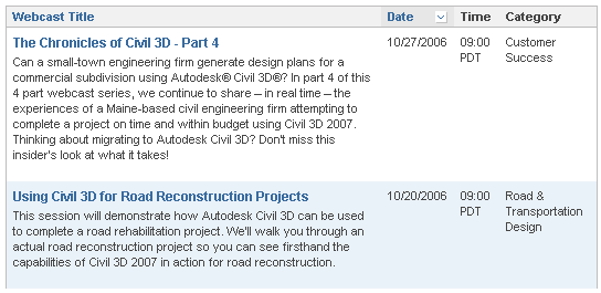 You now are required to register for the webcasts. So get signed up.
Be sure to click on webcasts located below the "featured webcast". If you select on a featured webcast, you will be taken to the Live Meeting website.

September 5, 2006
New Civil Community Web Site
As promised the new Civil 3D Community Website is up and running.
Follow the link and setup a profile and you will be on your way to an abundance of information.
http://civilcommunity.autodesk.com/
Key benefits of the community:
Peer network – Build member profiles, find and communicate with others who have similar interests, and start special-interest discussion groups.
Tips and training – Browse member-submitted productivity tips, detailed tutorials, training resources, and industry-related articles.
Content sharing – Upload/download templates, styles, design standards, reports, and custom utilities.
Blogs – Read blogs from Autodesk Civil 3D product management and marketing as well as members of the community.
Discussion groups – Participate in the Autodesk Civil Engineering Discussion groups, which are now integrated into the community experience.
Events – Search for partner events, user groups, and Autodesk webcasts from a central location
Follow the link and setup a profile and you will be on your way to an abundance of information.
http://civilcommunity.autodesk.com/
Key benefits of the community:
Peer network – Build member profiles, find and communicate with others who have similar interests, and start special-interest discussion groups.
Tips and training – Browse member-submitted productivity tips, detailed tutorials, training resources, and industry-related articles.
Content sharing – Upload/download templates, styles, design standards, reports, and custom utilities.
Blogs – Read blogs from Autodesk Civil 3D product management and marketing as well as members of the community.
Discussion groups – Participate in the Autodesk Civil Engineering Discussion groups, which are now integrated into the community experience.
Events – Search for partner events, user groups, and Autodesk webcasts from a central location
Service Pack 2 Now available
Follow the link:
http://usa.autodesk.com/adsk/servlet/ps/dl/item?siteID=123112&id=8021641&linkID=3549304
Service Pack 2 also contains all the fixes included in the Autodesk Map 2007 Service Packs 1 and 2.
Important:
The following standard template files (*.dwt) have been recreated due to issues found with Pipe Network Parts Lists. Some Network parts lists may be corrupt if you use .dwt files from the Autodesk Civil 3D 2007 release. The new template files will be posted at http://civilcommunity.autodesk.com/._Autodesk Civil 3D (Imperial) NCS Base.dwt_Autodesk Civil 3D (Imperial) NCS Classic.dwt_Autodesk Civil 3D (Imperial) NCS Extended.dwt_Autodesk Civil 3D (Metric) NCS Base.dwt_Autodesk Civil 3D (Metric) NCS Classic.dwt_Autodesk Civil 3D (Metric) NCS Extended.dwt
Important:
Version 1 of the Google Earth Extension is only compatible with Autodesk Civil 3D 2007 and Service Pack 1 or 1A and will be disabled after you install Autodesk Civil 3D 2007 Service Pack 2. In order to use the Google Earth Extension, after installing Autodesk Civil 3D 2007 Service Pack 2, you must download and install Release 2 of Google Earth Extension.
http://usa.autodesk.com/adsk/servlet/ps/dl/item?siteID=123112&id=8021641&linkID=3549304
Service Pack 2 also contains all the fixes included in the Autodesk Map 2007 Service Packs 1 and 2.
Important:
The following standard template files (*.dwt) have been recreated due to issues found with Pipe Network Parts Lists. Some Network parts lists may be corrupt if you use .dwt files from the Autodesk Civil 3D 2007 release. The new template files will be posted at http://civilcommunity.autodesk.com/._Autodesk Civil 3D (Imperial) NCS Base.dwt_Autodesk Civil 3D (Imperial) NCS Classic.dwt_Autodesk Civil 3D (Imperial) NCS Extended.dwt_Autodesk Civil 3D (Metric) NCS Base.dwt_Autodesk Civil 3D (Metric) NCS Classic.dwt_Autodesk Civil 3D (Metric) NCS Extended.dwt
Important:
Version 1 of the Google Earth Extension is only compatible with Autodesk Civil 3D 2007 and Service Pack 1 or 1A and will be disabled after you install Autodesk Civil 3D 2007 Service Pack 2. In order to use the Google Earth Extension, after installing Autodesk Civil 3D 2007 Service Pack 2, you must download and install Release 2 of Google Earth Extension.
August 29, 2006
Civil 3D Community
Autodesk has just revealed that a new website featuring Civil 3D and it's users will becoming live in the not so distant future. I would expect to see it after the holiday (wink).
 The new website will be a Civil 3D Community. This site will feature all the resources that most of you frequent in a normal day. The nice thing is that you can now go to one location and get all the info you need. It will feature a login and password and allow for customization of the content you will see based on your profile.
Some of the content will feature Tips and Training, Content Sharing, links to blogs, discussion groups, and online resources. It will also feature a My Network section that will profile users. There will also be a section listing events coming to your area.
Have you ever tried to find that link to the webcast so you could see what was up and coming. Look no further there is a complete list of all webcasts and events right on your home page.
From the sounds of it, this site is basically ours to do with what we want.
I do believe this is going to be a great resource for all of us. There has been a site like this in the Manufacturing sector for a while now. My "nuts and bolts" guys tell me it was awesome to have a site where you could find whatever it was you were looking for.
I will posting a link when the site becomes live (tweet... tweet... next week).
 The new website will be a Civil 3D Community. This site will feature all the resources that most of you frequent in a normal day. The nice thing is that you can now go to one location and get all the info you need. It will feature a login and password and allow for customization of the content you will see based on your profile.
Some of the content will feature Tips and Training, Content Sharing, links to blogs, discussion groups, and online resources. It will also feature a My Network section that will profile users. There will also be a section listing events coming to your area.
Have you ever tried to find that link to the webcast so you could see what was up and coming. Look no further there is a complete list of all webcasts and events right on your home page.
From the sounds of it, this site is basically ours to do with what we want.
I do believe this is going to be a great resource for all of us. There has been a site like this in the Manufacturing sector for a while now. My "nuts and bolts" guys tell me it was awesome to have a site where you could find whatever it was you were looking for.
I will posting a link when the site becomes live (tweet... tweet... next week).
July 28, 2006
Chronicles of Civil 3D
Date: Friday, July 28, 2006
Time: 9:00 a.m. - 10:00am (PDT)... That's the lunch hour for us "east coasters"
Simply register for the "Chronicles of Civil 3D" webcast.
(You must register for this webcast)
http://hub.autodesk.com/index.php/view/p/1481.html?ch=US_dotcom
Over the next few weeks, we will be able to see some of the "pain points" and satisfaction associated with Civil 3D and its implementation. I believe these webcasts are going to help a lot of the companies sitting on the fence trying to make that decision... Should we or Shouldn't we? I also believe that these webcasts may help some of those companies say: Hey! This is the future and what do we need to get there? How do we get up and running with little or no downtime? This stuff is new and different than the way we have always done it in the past with Land Desktop.
So, I invite you to drink the Kool-Aid and experience the refreshing new way to do things. Yes, it will be difficult and sometimes frustrating (speaking from experience), but the rewards can be endless.
Time: 9:00 a.m. - 10:00am (PDT)... That's the lunch hour for us "east coasters"
Simply register for the "Chronicles of Civil 3D" webcast.
(You must register for this webcast)
http://hub.autodesk.com/index.php/view/p/1481.html?ch=US_dotcom
Over the next few weeks, we will be able to see some of the "pain points" and satisfaction associated with Civil 3D and its implementation. I believe these webcasts are going to help a lot of the companies sitting on the fence trying to make that decision... Should we or Shouldn't we? I also believe that these webcasts may help some of those companies say: Hey! This is the future and what do we need to get there? How do we get up and running with little or no downtime? This stuff is new and different than the way we have always done it in the past with Land Desktop.
So, I invite you to drink the Kool-Aid and experience the refreshing new way to do things. Yes, it will be difficult and sometimes frustrating (speaking from experience), but the rewards can be endless.
July 25, 2006
Carlson Connect Now Available
Carlson Connect is now available for Civil 3D 2007 and LDT 2007. These utilites are 3rd party applications that help aid in the communication of data collectors and Autodesk Software.
Follow the Link.
http://update.carlsonsw.com/updates.php
Well I'm off to Manchester to see the Civil 3D crew. Then a little flounder fishing (hopefully a few "doormats" are still around.
Follow the Link.
http://update.carlsonsw.com/updates.php
Well I'm off to Manchester to see the Civil 3D crew. Then a little flounder fishing (hopefully a few "doormats" are still around.
July 12, 2006
New White Papers
There have been two new white papers posted to the Autodesk Website.
Using Civil 3D for Large subdivision design
by Andrew Walther, PE
Autodesk Civil 3D 2007 Styles: An Updated Guide to the Fundamentals
by Mark Scacco, PE
CHECK THESE OUT. There is a lot of valuable information and insight into how this program works and how to apply the functionality.
Follow the link to download or view.
http://usa.autodesk.com/adsk/servlet/index?siteID=123112&id=5173807
Using Civil 3D for Large subdivision design
by Andrew Walther, PE
Autodesk Civil 3D 2007 Styles: An Updated Guide to the Fundamentals
by Mark Scacco, PE
CHECK THESE OUT. There is a lot of valuable information and insight into how this program works and how to apply the functionality.
Follow the link to download or view.
http://usa.autodesk.com/adsk/servlet/index?siteID=123112&id=5173807
July 11, 2006
Google Earth Extension Beta Available for AutoCAD 2007-Based Products
The Google Earth™ Extension for the AutoCAD® 2007, Autodesk® Architectural Desktop 2007, Autodesk® Civil 3D®, and Autodesk Map® 3D 2007 software products is now available for Beta testing on the Autodesk Labs website. http://labs.autodesk.com
(Note: This Beta Program is subject to the terms and conditions of the end-user license agreement that accompanies download of the software.)
This is a public Beta and Autodesk would like your valuable feedback while you explore this new application.
This publishing tool is designed specifically to meet the needs of architects, designers, and engineers who use Autodesk products. With the easy-to-use, wizard-driven interface, users can publish 3D models directly from AutoCAD into Google Earth.
As users you can deliver high-impact presentations at planning board meetings or public hearings, streamline the preliminary project planning process, share conceptual plans with your clients as they develop, connect everyone involved in your project, from the planning stage through to public approval.
(Note: This Beta Program is subject to the terms and conditions of the end-user license agreement that accompanies download of the software.)
This is a public Beta and Autodesk would like your valuable feedback while you explore this new application.
This publishing tool is designed specifically to meet the needs of architects, designers, and engineers who use Autodesk products. With the easy-to-use, wizard-driven interface, users can publish 3D models directly from AutoCAD into Google Earth.
As users you can deliver high-impact presentations at planning board meetings or public hearings, streamline the preliminary project planning process, share conceptual plans with your clients as they develop, connect everyone involved in your project, from the planning stage through to public approval.
July 10, 2006
LDT & Civil Design SP's Available
The SP's for LDT 2007 & Civil Design 2007 have been released.
Follow the Links...
LDT 2006 SP1
http://usa.autodesk.com/adsk/servlet/ps/dl/item?siteID=123112&id=7577259&linkID=3549304
Civil Design 2007 SP1
http://usa.autodesk.com/adsk/servlet/ps/dl/item?siteID=123112&id=7577280&linkID=3549304
*** PLEASE READ THE README FILE ASSOCIATED WITH THE DOWNLOADS ***
Important: If you have Autodesk Civil 3D 2007 and Autodesk Land Desktop 2007 both installed on the same computer, you must also install the Autodesk Civil 3D 2007 Service Pack 1A. For more information, see Installation Information for Side-By-Side Installs. It is also strongly recommended that you install the Autodesk Land Desktop Service Pack 1 before installing the Autodesk Civil 3D - Civil Design 2007 Service Pack 1.
Installation Information for Side-By-Side Installs
If you have additional AutoCAD-based products installed on your computer, you may need to apply additional service packs to ensure all the products continue to work properly after you install the Autodesk Land Desktop 2007 Service Pack 1 (or the Autodesk Civil 3D - Civil Design Companion 2007 Service Pack 1).
These include the following service packs:
AutoCAD 2007 SP1
Autodesk Architectural Desktop 2007 SP1
Autodesk Map 3D 2007 SP1
Autodesk Civil 3D 2007 SP1A
For example, if you have Autodesk Land Desktop 2007 installed on the same computer as Autodesk Civil 3D 2007, you must install both Autodesk Land Desktop 2007 Service Pack 1 and Autodesk Civil 3D 2007 Service Pack 1A to ensure both products continue to work properly.
Follow the Links...
LDT 2006 SP1
http://usa.autodesk.com/adsk/servlet/ps/dl/item?siteID=123112&id=7577259&linkID=3549304
Civil Design 2007 SP1
http://usa.autodesk.com/adsk/servlet/ps/dl/item?siteID=123112&id=7577280&linkID=3549304
*** PLEASE READ THE README FILE ASSOCIATED WITH THE DOWNLOADS ***
Important: If you have Autodesk Civil 3D 2007 and Autodesk Land Desktop 2007 both installed on the same computer, you must also install the Autodesk Civil 3D 2007 Service Pack 1A. For more information, see Installation Information for Side-By-Side Installs. It is also strongly recommended that you install the Autodesk Land Desktop Service Pack 1 before installing the Autodesk Civil 3D - Civil Design 2007 Service Pack 1.
Installation Information for Side-By-Side Installs
If you have additional AutoCAD-based products installed on your computer, you may need to apply additional service packs to ensure all the products continue to work properly after you install the Autodesk Land Desktop 2007 Service Pack 1 (or the Autodesk Civil 3D - Civil Design Companion 2007 Service Pack 1).
These include the following service packs:
AutoCAD 2007 SP1
Autodesk Architectural Desktop 2007 SP1
Autodesk Map 3D 2007 SP1
Autodesk Civil 3D 2007 SP1A
For example, if you have Autodesk Land Desktop 2007 installed on the same computer as Autodesk Civil 3D 2007, you must install both Autodesk Land Desktop 2007 Service Pack 1 and Autodesk Civil 3D 2007 Service Pack 1A to ensure both products continue to work properly.
June 29, 2006
It's Here - SP1a
It has finally arrived. SP1a is now available for download.
Follow the link.
http://usa.autodesk.com/adsk/servlet/ps/dl/index?siteID=123112&id=2334435&linkID=3549304
Follow the link.
http://usa.autodesk.com/adsk/servlet/ps/dl/index?siteID=123112&id=2334435&linkID=3549304
June 27, 2006
Will It Arrive... SP1a
It has been announced that the new arrival of service pack SP1a will be out tomorrow (June 28). Will it be ready? I am anxiously awaiting the fix, because of several "weird" things that have been occurring. I will get into this I a bit more detail over the weeks.
I apologize for not posting more often, but life has been crazy. I am basically training/implementing Civil 3D about every day. I am literally booked out unitl October. This is good for me but does not leave alot of extra time to post.
PS, Thanks Dana and Peter for the Comma workaround. I can see a smile on Scott's face.
I apologize for not posting more often, but life has been crazy. I am basically training/implementing Civil 3D about every day. I am literally booked out unitl October. This is good for me but does not leave alot of extra time to post.
PS, Thanks Dana and Peter for the Comma workaround. I can see a smile on Scott's face.
May 26, 2006
New Toy! - Publish to Google Earth
Autodesk has given us a new tool to play with... a new extension to publish Civil 3D to Google Earth. Now this is a different program than the one that was shown to us a couple of weeks ago, which was EXPORTGOOGLEEARTH.
Here is a list of some key features.
- Take complete control over the data you want to publish and how you want it to display including symbology and elevation
- Add layers of available Google Earth data including buildings, transportation systems, roads, etc to view your project within the context of the surrounding area
- Publish Civil 3D objects as Google Earth placemarks allowing you to quickly locate and navigate to a specific place on your project site
-Create drive-throughs along road centerlines and save snapshot views of your project site from different vantage points
- Associate points in your Civil 3D model with realistic 3D content (in KML format) such as light poles along a street, houses, or cars
- Publish your data using the coordinate system already specified in your drawing, pick from over 100 coordinate systems at publishing time, or apply a user-defined coordinate system.
Publish to Google Earth. The Autodesk® Civil 3D® 2007 Extension for Google Earth™ allows you to publish intelligent Civil 3D objects (geometry and metadata) including points, parcels, alignments, corridor models, surfaces, and hydraulic networks directly from Civil 3D to Google Earth. Through the wizard-driven interface, you have complete control over what data you want to publish and how you want it to display including symbology and elevation.
Download the Autodesk Civil 3D 2007 Extension for Google Earth:
http://usa.autodesk.com/adsk/servlet/index?siteID=123112&id=7294687&linkID=3549304
Download Google Earth:
http://earth.google.com/
Important: To install the Autodesk Civil 3D 2007 Extension for Google Earth, you must have Autodesk Civil 3D 2007 already installed. To run the Autodesk Civil 3D 2007 Extension for Google Earth, you must also have Google Earth installed. The Autodesk Civil 3D 2007 Extension for Google Earth works with the free version of Google Earth, Google Earth Plus and Google Earth Pro.
Here is a list of some key features.
- Take complete control over the data you want to publish and how you want it to display including symbology and elevation
- Add layers of available Google Earth data including buildings, transportation systems, roads, etc to view your project within the context of the surrounding area
- Publish Civil 3D objects as Google Earth placemarks allowing you to quickly locate and navigate to a specific place on your project site
-Create drive-throughs along road centerlines and save snapshot views of your project site from different vantage points
- Associate points in your Civil 3D model with realistic 3D content (in KML format) such as light poles along a street, houses, or cars
- Publish your data using the coordinate system already specified in your drawing, pick from over 100 coordinate systems at publishing time, or apply a user-defined coordinate system.
Publish to Google Earth. The Autodesk® Civil 3D® 2007 Extension for Google Earth™ allows you to publish intelligent Civil 3D objects (geometry and metadata) including points, parcels, alignments, corridor models, surfaces, and hydraulic networks directly from Civil 3D to Google Earth. Through the wizard-driven interface, you have complete control over what data you want to publish and how you want it to display including symbology and elevation.
Download the Autodesk Civil 3D 2007 Extension for Google Earth:
http://usa.autodesk.com/adsk/servlet/index?siteID=123112&id=7294687&linkID=3549304
Download Google Earth:
http://earth.google.com/
Important: To install the Autodesk Civil 3D 2007 Extension for Google Earth, you must have Autodesk Civil 3D 2007 already installed. To run the Autodesk Civil 3D 2007 Extension for Google Earth, you must also have Google Earth installed. The Autodesk Civil 3D 2007 Extension for Google Earth works with the free version of Google Earth, Google Earth Plus and Google Earth Pro.
May 5, 2006
Trimble Link Now Available
The Trimble Link software is now abailable for the LDT and Civil 3D 2007.
Follow the Link: http://www.trimble.com/link_ts.asp?Nav=Collection-27103
Follow the Link: http://www.trimble.com/link_ts.asp?Nav=Collection-27103
May 2, 2006
Getting Back Into the Groove
Sorry I haven't posted in a while. I had a new addittion to the family, a baby girl. So things are starting to get back to normal, if that is possible. I will be posting shortly on some of the new features along with some tricks for the new products.
A question for you... What is it that you want to know more about?
I also got some comments that this info is great but most users were not able to go in and see for themselves the functionality. It seems like everyone is still waiting to recieve their software.
A question for you... What is it that you want to know more about?
I also got some comments that this info is great but most users were not able to go in and see for themselves the functionality. It seems like everyone is still waiting to recieve their software.
Subscribe to:
Posts (Atom)